
Hike to Camp Muir, Mount Rainier's Base Camp Above the Clouds

Every once in a while we like to go back and hike to Camp Muir. It's the views, but also the challenge that 10 miles over 4600 ft of elevation gain represents. Those last sixty or so minutes are the toughest! But when you reach the 10080ft high camp, not much else can beat the surroundings, and before the day is over and you're dog tired descending back into the Paradise area, you're glad to have spent 12+ hours on the majestic slopes of Mount Rainier.
Camping at Cougar Rock, Mt. Rainier National Park
Camp Muir is a day hike but, this time, Timea, John and I decided to camp at Cougar Rock near Longmire, so we can get a very early start the following day, and see the sunrise from higher up the mountain. This was also a great opportunity to unwind with a few beers after a long week.
The campground is lower down the mountain in a densely forested area but, right from our site, we could spot Mount Rainier through the foliage, almost as a reminder for the great day ahead of us.

Our camp site at Cougar Rock Campground near Longmire, Mount Rainier National Park
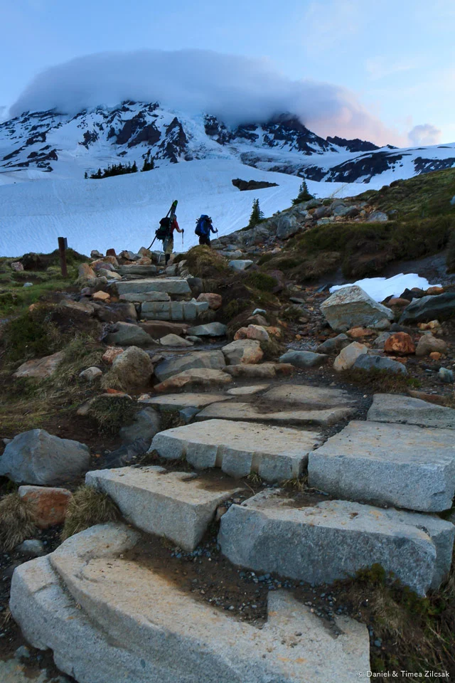
Paradise to Camp Muir
We woke up at 3 am, packed up our camp, and drove the 25 minutes to Paradise, where the trail to Camp Muir begins.
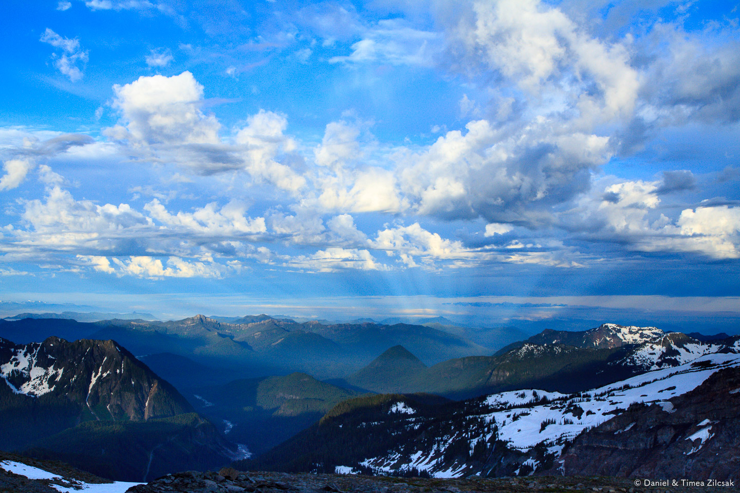
At the trailhead, the Henry M. Jackson Visitor Center, the ranger station, the entire parking lot, and everything else was enveloped in a dense fog/low clouds. However, we started hiking and about 10 minutes in, we left it all behind and glorious views began to open up.
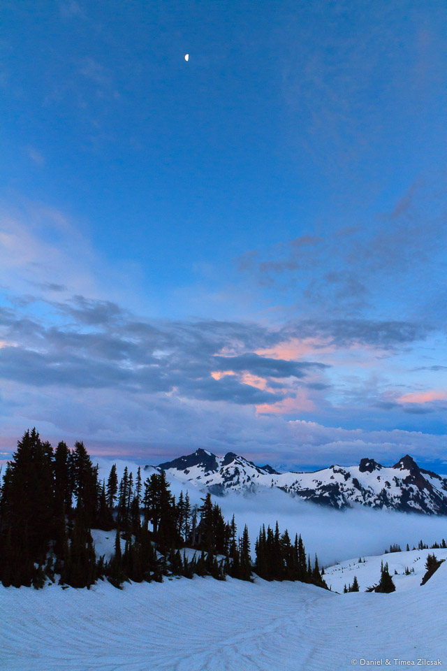
Moon over Tatoosh Range before sunrise. Clouds over Paradise and the lower mountain, Mount Rainier National Park
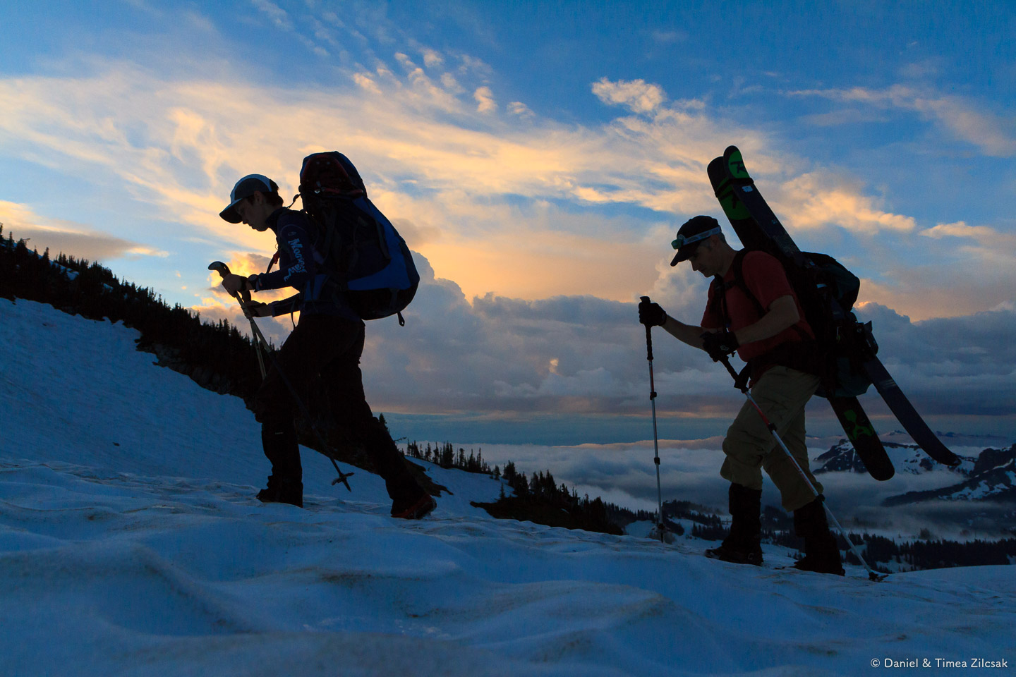
Skyline Trail and Panorama Point
The first section of the hike to Camp Muir is about reaching Panorama Point. While in the winter/spring this section is completely covered in snow (the entire hike to Camp Muir is), this year did not see an abundant amount of snow and the trail had patches of dirt/rock.
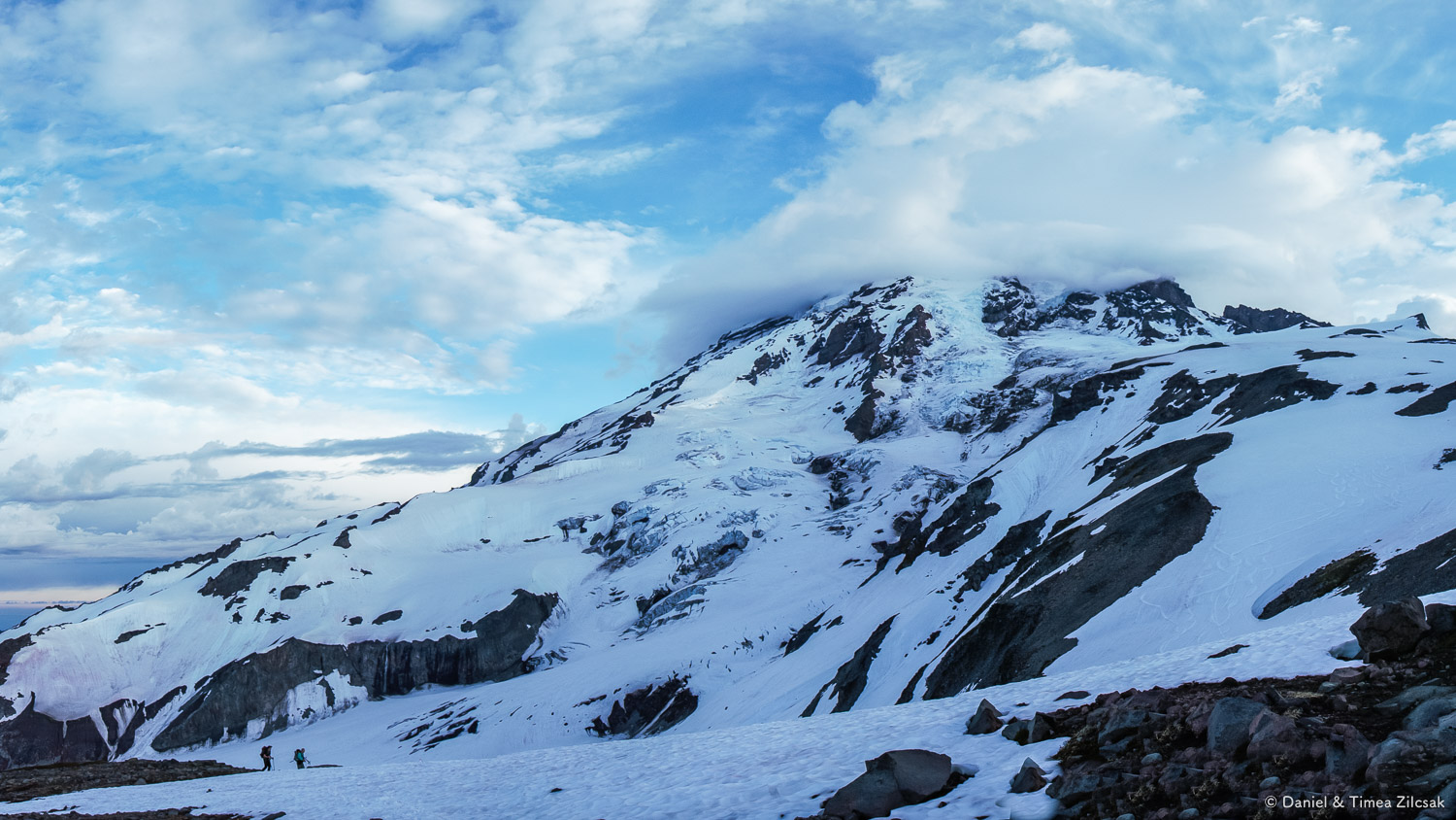
Looking up we could see Mount Rainier sporting a lenticular cloud cap.
Skyline trail at sunrise with lenticular cloud over Mount Rainier
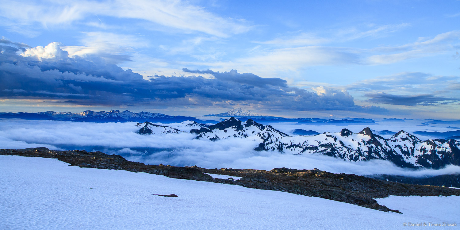
About 40 minutes into our hike, while following the summer trail towards Panorama Point, we got hiker and hiker and began to see further south. Such a spectacular view with all the low clouds covering the Cascade peaks!


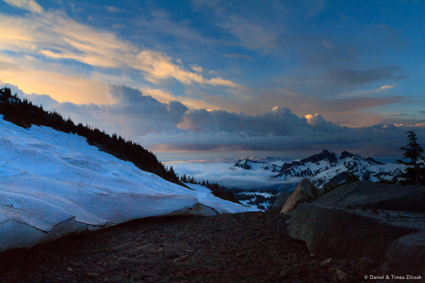

Pebble Creek
Not long after we passed Panorama Point we realized that it was time for a snack break. We found a good, dry spot on some rocks which, according to the map, were about 300 yards south west from McClure Rock, at 7200ft. This is also the point where the Muir permanent snowfield begins. From this elevation, Mount Adams and Hood were clearly visible on the horizon, and the Cascades were all blanketed in fog. The complete silence, and those views, made for a special breakfast.

Timea and John resting just below McClure Rock ~7200 ft, near the beginning of the Muir snowfield, Mount Rainier National Park
The Muir Snowfield
Break was over and it was time to climb some more. It was going to be snow all the way to Camp Muir, or about 2700 ft of elevation left. Along the way we saw a few tents to the left of the boot path. It must have been really nice to wake up at 8000 ft with that picture perfect view; probably also very cold during the night.

Timea and John hiking the upper part of the Muir Snowfield on our way to Camp Muir, Mount Rainier National Park, passing a high altitude camp along the way (top/right)

On our way to Camp Muir, Mount Rainier always in front of us
Moon Rocks
We must have hiked for an hour or more from our previous break to reach the Moon Rocks. At above 9000 ft this is another good place to take a break, probably the last one before Camp Muir. From here you can clearly see the line of hikers making their way up the mountain. It's a great sight. The Cascades below look like hills from this elevation.

The Cascade Mountains look like hills from 9k on the Muir snowfield near Moon Rocks and Camp Muir
You can also see the big three again. Mount Adams, at 12,281 ft. high, is the second highest mountain in the state of Washington.

Mt. Adams 12,281 ft. and the Tatoosh range seen from 9000 ft. en route to Camp Muir, Mount Rainier National Park
Below, equally impressive Mount St. Helens, an active volcano that is mostly known for its violent 1980 eruption that blew up its summit in a massive explosion, bringing its height down from 9,677 ft. to 8,365 ft. in just a few moments.

The Mt. Saint Helens active volcano - 8,365 ft high
And now a shot with all three giants into the same frame:

Mount Adams (left), Mount Hood (center) and Mount St. Helens (right)
Camp Muir
Finally, after about four and a half hours, we reached Camp Muir. The last 30 minutes or so are the hardest because you see the hut, you see the destination, and you feel that you are very close. But you're not! Every step takes more effort because of the elevation, and the image of the huts you saw 10 minutes ago looks about the same, and you're closer, but not there yet. You start counting steps, huff and puff, and wonder how is everybody else feeling. But you keep going, one step at a time and you eventually make it, and boy it feel good to lay down and rest.

View from Camp Muir, the Rainier base camp above the clouds - more precisely 10080 ft high.
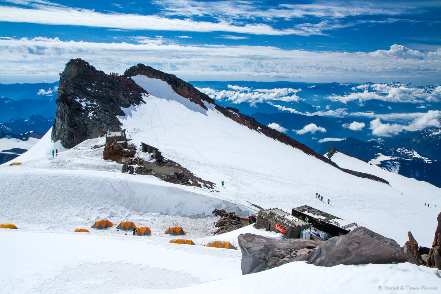
View of Camp Muir from above, including climbers' tents, guides' huts, and the public shelter

Camp Muir: climbers practicing mountaineering skills on the steeper slope below
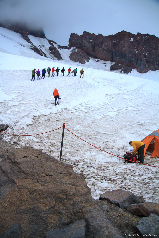
Camp Muir: the same group heading towards the dining tent, or more training (only their guide knows what was next)

View from Camp Muir: the main shelter/hut and climbers' tents with Mount Adams right below the clouds
What a great day in the mountains! Happy hiking folks!
Camp Muir
Mountaineering / Overnight / Day Hike • Washington / Mount Rainier National Park / Paradise•
Distance: 10 miles roundtrip
Elevation: 4640' gain, 10040' high point
•
Alpine • Camp • Classic • Creek • Crevasse • Favorite • Glacier • Mountain • National Park • Off Trail • Ridge • Scrambling • Snow • Snowshoeing • Training Hike • Views • Volcano • Winter Hike
•Permit: National Park Day or Yearly Pass
Trailhead: 46.7853993, -121.7357097
Map: Green Trails Paradise 270S, WTA Guide

Paradise to Camp Muir: we took Skyline Trail, Pebble Creek Trail and Camp Muir Trail (on the Muir Snowfield). Map provided as information only, do not use for travel!
WARNING: Be aware that hiking to Camp Muir is very dangerous in less than perfect weather. Know everything about it before you go. Carry the 10 essentials. Know how to use a compass, proper map and/or GPS. Read more on the NPS website or this NPS Camp Muir brochure. Also check out the Mount Rainier web cams, including one at Camp Muir.