
Hiking Silver Peak via Cold Creek Trail

Silver Peak is a great short hike that rewards you with outstanding views of the Snoqualmie Pass peaks including Mount Rainier. Got a free afternoon? Go hike it.
First Attempt
Timea and I hiked a lot of Mount Si, Mailbox Peak, and other popular trails in the past. This week, though, we thought about trying something different, where we've never been before. And Silver Peak looked like a great choice.
Cold Creek Trail
As we arrived at the trailhead, we only saw 4 cars in the parking lot. We knew right there that we won't see any crowds - common on popular trails. We also assumed we might see some wildlife along the way. We were right about the crowds, but wrong about wildlife, as we have not seen a single animal all day long.

Cold Creek Trailhead
The trail was nearly flat for almost a mile until we reached Twin Lakes; The forest was quite dense, and we were accompanied by the stream almost the entire time.

Crossing a small stream

Cold Creek downstream from Twin Lakes
At 0.8 miles we came to a trail junction that marks the entrance to the loop leading to Silver Peak. We took a left turn towards the Pacific Crest Trail (PCT), and towards Silver Peak. The other side leads to Mount Catherine.

Cold Creek Trail No 1303, towards the PCT

Log bridge across Cold Creek, on the east side of Twin Lakes
Across the creek and around the lake the trail has become steeper and a lot rougher than the previous section. After about 30 minutes from the lake, we encountered the first hiker coming down. He surprised us with the sad news that the traverse towards Silver Peak was covered in snow and quite steep and exposed. He had to turn around and was now returning to the trail head. We continued on for another 15 minutes, passing another couple going up, and eventually merged into the PCT.
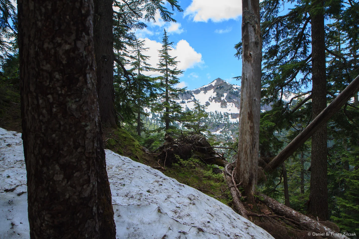
Silver Peak from the upper Cold Creek trail
At the PCT junction, we turned right and after not more than 10 minutes, we reached the un-passable steep snowed-in section. We had no other way but to turn around. Without some form of traction, this part looked dangerous.
Twin Lakes
On the way back, we stopped at the Twin Lakes for a few minutes, then returned to the car, taking a few more photos along the way.

East Twin Lake, Snoqualmie Pass
We'll definitely be back before long, to finish what we started.
Update: Silver Peak Summit
We returned to Silver Peak in October 2015 and made it to the summit this time. The peak is rocky and stands tall above the region with great views all around all the way to Mount Rainier. It's become one of our favorites now!

On the rocky summit of Silver Peak, Snoqualmie Pass

Timea and Nikki on the very summit of Silver Peak

Mount Rainier seen from Silver Peak
Got a free afternoon? Go hike Silver Peak!
Silver Peak
Day Hike • Washington / Central Cascades / I90 / Snoqualmie Pass•
Distance: 5,6 miles roundtrip
Elevation: 2100' gain, 5600' high point
•
Alpine • Favorite • Forest • Mountain • Scrambling • Summit • Ridge • Views • Wildlife
•Permit: Northwest Forest Pass
Trailhead: 47.3731211, -121.4469159
Map: Green Trails Snoqualmie Pass 207, WTA Guide

Map of our attempt to reach Silver Peak via Cold Creek trail