
Anvil Rock - A Secret Detour on Your Way to Camp Muir

What can be better than a high altitude hike on the slopes of majestic Mt Rainier, one where you reach the iconic Camp Muir and you enjoy views that stretch for hundreds of miles from east to west?
A Secret Detour
Scores of people climb to Camp Muir every day throughout the year, but most stick to the beaten path. Why? Because, by the time they reach this little detour, they're all tired, all they can think about is getting there, getting there, getting there, and miss this rock altogether.
Just like everybody else, we did the same; until this nice and sunny Saturday when we followed fellow Seattle Mountaineers to this secret detour which is Anvil Rock.
Our expectations were not that high. We signed up for this trip mostly because we needed to kick start the season. Later this year we're attempting to climb Mt Baker and need the conditioning.
It turned out it had been a great idea. We were pleasantly surprised when we saw what lies to the east of the Muir snow field, a viewpoint so close to the trail we climbed so many times throughout the years, yet never visited before.

John taking a photo of the Cowlitz Glacier, to the east of Anvil Rock
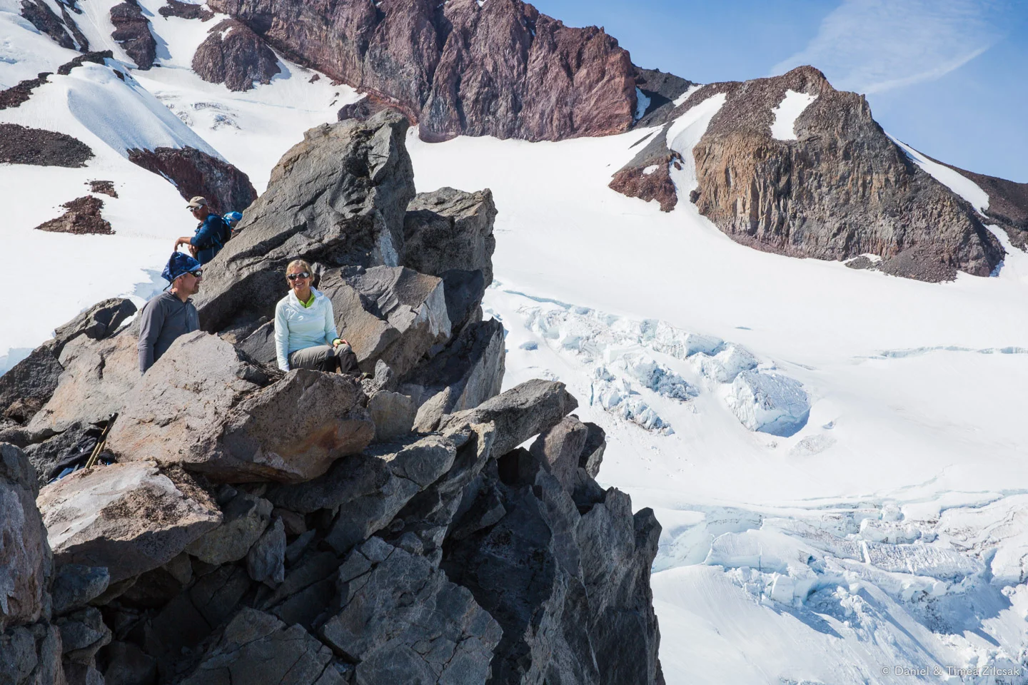
Our hiking buddies enjoying the views from the top of Anvil Rock
So, go hike Anvil Rock
So, on your next hike to Camp Muir, or even if you go there for the first time, it's worth the extra 10 minute detour to get to Anvil Rock and claim the 3rd peak on the Mountaineers 100 Peaks at Mount Rainier but also to see the classic Camp Muir boot path from a different angle.
I hope I convinced you with that, but if not, here are some more photos from this trip:

Climber on the Muir Snow Field, Mount Rainier National Park
A climber putting one step in front of the other, after hiking 4000 vertical feet from the trail head, most likely feeling the effects of altitude. Up here, at 9600ft the air density is 40% that at sea level.

Pack of climbers on the Muir Snowfield below Nisqually Glacier, approx. 9600 ft high
I like the previous image because it shows the sheer size of Mount Rainier's glaciers and rock walls, but also the next one, where we see camp the Camp Muir hut with Mt Adams peeking above the clouds, which rose to 8000ft that day.

A camp with an outstanding view, Camp Muir, the Mount Rainier base camp

Climbing teams reaching Camp Muir, for a break before they Mount Rainier summit attempt
These folks must have feelt very good because camp was in their sight. Another 5 or 10 more minutes and they could unload the mother-in-law (the backpack) and rest before their summit attempt early the following morning.
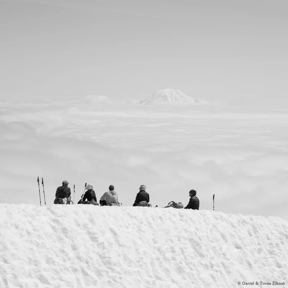
Lunch above the clouds, Camp Muir, Mount Rainier National Park
I hope I could convince you to take the Anvil Rock detour on your next trip here, and, if you have not done it yet, hike to Camp Muir before long.
Thanks for reading!
Anvil Rock
Day Hike / Mountaineering / Overnight • Washington / Mount Rainier National Park•
Distance: 9 miles roundtrip
Elevation: 4240' gain, 9600' high point
•
Alpine • Camp • Classic • Creek • Crevasse • Favorite • Glacier • Mountain • National Park • Off Trail • Ridge • Scrambling • Snow • Snowshoeing • Training Hike • Views • Volcano • Winter Hike
•Permit: National Park Day or Yearly Pass
Location: 46.7853993, -121.7357097
Map: Green Trails Paradise 270S, WTA Guide
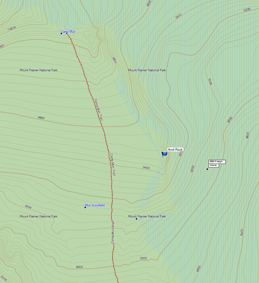
Map of Anvil Rock in relation to the Camp Muir boot path